Mapping the Past

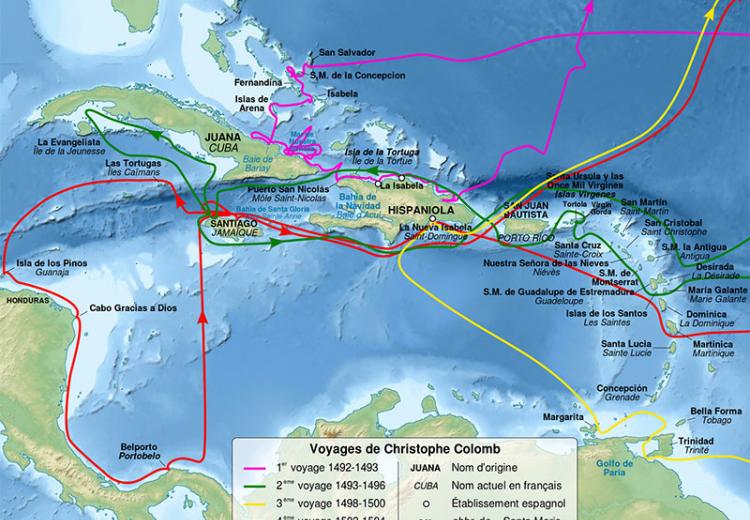
Map of Christopher Columbus voyages, between 1492 and 1504.
This lesson provides students with opportunities to work with historical maps as cultural artifacts that reflect the views of particular times and places. Students begin by examining European world maps from three eras -- the Middle Ages, the Age of Discovery, and the period of New World exploration -- in order to discover how people of those times understood their world and interacted with it. Then students look at maps that record the early exploration of the American West, noting how mapmakers kept alive hopes of finding a Northwest Passage and how this hope is reflected in what Lewis and Clark marked as significant on the map produced by their expedition. Finally, students collect present-day maps, using library and/or Internet resources, to investigate the range of perspectives we adopt toward our world and how our maps reflect our own cultural concerns and aspirations.
Guiding Questions
What do maps tell us about how the world is organized?
Why is it important to know who makes a map?
Learning Objectives
Analyze historical maps to determine how they inform our understanding of time and place.
Analyze maps to learn how world views from medieval times through the Renaissance informed cartography.
Evaluate how cultural assumptions influenced the process of mapping the American West.
Evaluate what present-day maps can tell us about changes over time and contemporary world views.
